Start with the sort of day you want
The Nordkette fills the view from central Innsbruck, which makes heading straight up tempting. First decide how much of the day you want to spend walking. An hour beside the Inn, a wooded hillside outing and a high mountain route need different preparation. Choose the route before you choose the photograph you want to bring home.
This is an introduction to walking areas. It does not supply trail grades, verified tracks or turn-by-turn directions.
Stay beside the Inn for an easy change of scene
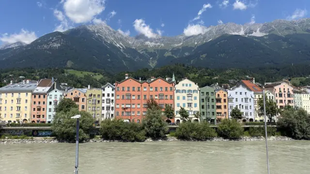
For time outside without a mountain itinerary, follow the riverfront and use the bridges to change your view of the city. Around Mariahilf, look back across the water towards the Old Town. Keep cycle routes clear when you stop, and check local access notices along the paths.

Image details and reuse terms
Look at the lower slopes around Hungerburg
The wooded slopes around Hungerburg are a different proposition from walking through town. One destination to research is Arzler Alm, a mountain hut at the foot of the Nordkette with walking approaches from Hungerburg. Choose a permitted route using current local information; check the hut separately if a meal is part of your plan.
Check the surface and current conditions too: a low path can still be icy or affected by storm damage.
It helps to work backwards from your return. Decide where you need to finish, how you will get back and how much time that leaves for stops. A route that only just fits the available time leaves little room for a slower section.
The Nordkette: views and serious terrain
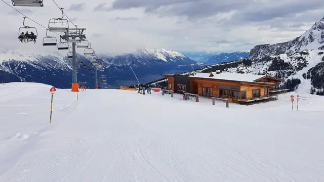
From the Nordkette, the city becomes a small part of a much wider valley. That view is reason enough for a visit. You do not need to add a hike to justify going up.

Image details and reuse terms
If you do plan to walk, use current route descriptions and qualified local advice to judge the terrain. The Nordkette operator lists access notices and lift information. Mountain weather, exposed ground and the last return connection all matter; the cable car ride does not make a route suitable for every visitor.
The Zirbenweg: look across the valley
On the other side of Innsbruck, the Zirbenweg runs from the Patscherkofel lift area towards Tulfeinalm and the Glungezerbahn. Stone pine woodland is part of its appeal, with views across the Inn valley towards the Nordkette. It gives you a different angle on the mountains you see from town.
Research the full journey before choosing it. This is a route between lift areas, so you need a plan for both ends, current lift access and the return to Innsbruck. Read the official route description and conditions rather than assuming a panoramic path is suitable for your group.
Give a valley walk a day of its own
The Stubai Valley is worth considering when you want the walk to be the focus of the day. Choose a village or trailhead and a specific route before arranging transport. A valley name covers too much ground to be a walking plan.

Image details and reuse terms
Seefeld is another base to compare. Look at route descriptions for your season, including climbing, surface and how you reach the start. The same region can offer gentle paths and demanding terrain.
Pack for a change in the weather
Carry water, food, layers and navigation you can use without a mobile signal. Choose footwear and equipment for the actual route. Before leaving, check current conditions and tell someone your plan. Read the tourism authority’s mountain safety guidance and ask for qualified advice when the terrain is beyond your experience.
Turning back early can leave you time for a good afternoon in town. Keep the Old Town and museum ideas handy, follow closures and leave the high route for a day when it suits your preparation.